FieldGrid, the MGRS and UTM grid app for land navigation
UTM Grid, Compass & Land Nav
Point FieldGrid at a spot and it hands back an 8-digit MGRS grid, a UTM coordinate or decimal lat/long, straight off the phone's own GPS, no cell bars needed. We built it for land nav lanes where a street-address coordinate app is no use. It works for search and rescue, hunting, hiking, or anyone who has to call a position in as a grid instead of a pin on a map.

Map And Marks
Range rings for judging distance
Field Tools
Lensatic compass in degrees and NATO mils
Field Tools
Pace counter
Field Tools
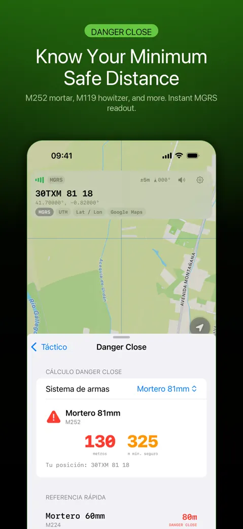
Danger close reference distances by weapon system
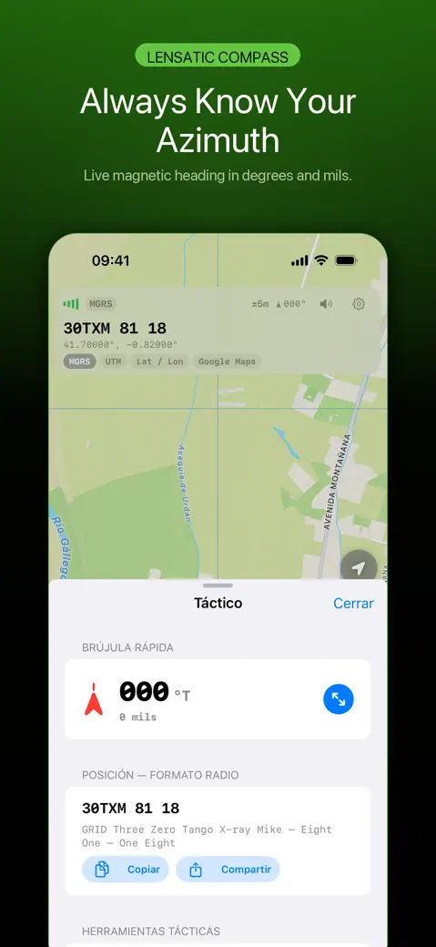
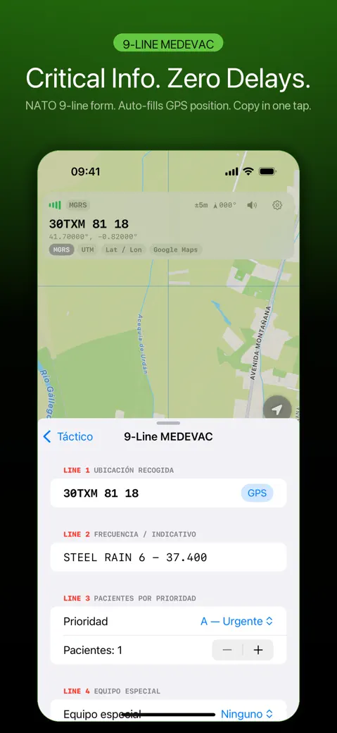
What you can do with FieldGrid
Know your grid
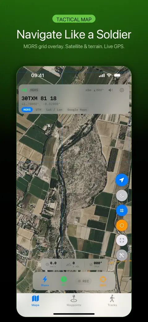
- Read your position live on the Map tab as MGRS, UTM, Lat / Lon or a Google Maps link, with a second format underneath and the GPS accuracy in metres next to it.
- Tap the grid to copy it, press and hold to share it, or tap the speaker button to hear it read in the NATO alphabet ("Niner" for 9).
- Spell it for the radio: Tactical tools > POSITION — RADIO FORMAT writes out the whole grid so you can copy or share the text.
Mark and find points
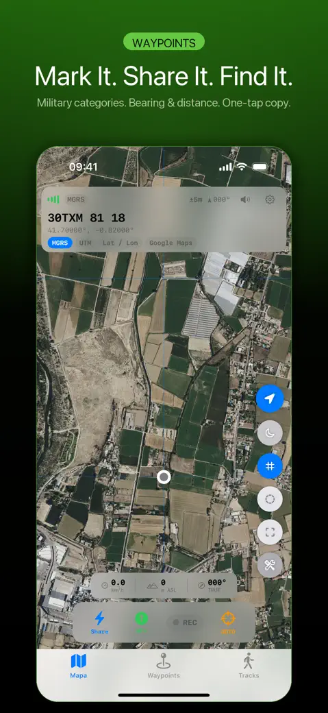
- Save waypoints at your position with WP+, by pressing and holding the map, or by typing an MGRS grid or decimal lat/long. The Waypoints list shows distance and true bearing from you to each one.
- Project a point you can see: By distance and bearing… takes metres or kilometres and degrees or mils and saves the resulting grid.
- Jump the map to any MGRS grid or lat/long with GOTO, and share waypoints as a GPX file for other mapping tools.
Field tools
- A compass in degrees true and NATO mils (6,400 to a circle).
- A tap-based pace counter with a mission clock that works out distance and speed.
- Sun & Moon: BMNT, EENT, sunrise, sunset, all twilights, moonrise, moonset and moon illumination for today at your position.
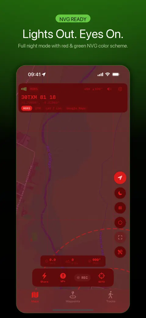
- Night mode with a red overlay, range rings and a centre crosshair that shows the grid under it.
Quick start
- Open FieldGrid and allow location while using the app. Without it the map shows GPS UNAVAILABLE and an OPEN SETTINGS button.
- Wait until the accuracy next to the grid drops to a few metres.
- Read your grid at the top of the Map tab. At 37.74870, -119.58720 it reads 11SKB 7205 8108.
- To change the big format, open the gear, then Settings > Coordinate format and pick the Primary and Secondary formats.
- Press WP+ to save where you stand, or press and hold it for more ways to add a point.
Free, and what the optional Pro adds
FieldGrid costs nothing to download, and it shows ads. Every coordinate format, the compass, the pace counter, Sun & Moon, the report templates, the widget and up to 5 waypoints come free. Watch a short rewarded ad and you get one more waypoint slot, permanently, for that ad.
FieldGrid Pro is a monthly or yearly subscription, or a one-time lifetime buy if you'd rather pay once and forget about it. It adds unlimited waypoints, track recording with the Tracks tab and GPX export of tracks, export of all waypoints at once, Apple Watch use with no 5-minute cap, and drops every ad.
Privacy, offline use and permissions
Your position, grids, compass, waypoints, offset tool, pace counter and sun and moon times all come straight from the phone, no cell signal required. The map picture underneath is Apple Maps, and that part does need data. Lose signal and you still get your grid; you just lose the pretty background behind it, since there is no offline map download.
No account to create, no login screen, nothing. Waypoints and tracks stay on your device and on your own Apple Watch, full stop. The free version does load Google ads, which is why iOS pops up the tracking prompt; tapping no there still leaves every feature working exactly the same.
Limits worth knowing before you rely on it
- MGRS is always 8 digits (a 10 m square). There is no 6- or 10-digit option and no degrees-minutes-seconds format.
- The MGRS grid map overlay draws latitude and longitude lines, not the 1 km squares of a paper map. Plot from the numbers, not the drawn lines.
- The compass is the phone's magnetometer showing true heading, with no declination setting. It is not a lensatic compass.
- Units are metric only: metres, kilometres and km/h.
How-to guides for FieldGrid
Questions people ask about FieldGrid
Is FieldGrid free?
Does FieldGrid need cell service?
Does it work on iPad and Apple Watch?
Which coordinate formats does it show?
Does it replace a map and compass?
Free and Pro
Free
- Live position in MGRS or USNG (4, 6, 8 or 10 digits, default 8), UTM, decimal Lat / Lon, DMS and a Google Maps link, primary + secondary format; datums WGS 84, NAD 27, ED50, OSGB 36
- Copy / share the grid, NATO phonetic readout (text and spoken aloud)
- Map with Apple standard or satellite imagery, night mode (NVG red), real UTM/MGRS grid lines (100 km, 10 km, 1 km, 100 m by zoom) with grid zone / 100 km square labels, range rings, centre crosshair, bearing line to selected waypoint
- Navigate screen: big arrow, distance and bearing (degrees and mils) to a waypoint; 'Mark my car' in one tap (one Car waypoint that is moved on later taps)
- Map drawings: lines, circles, polygons and sectors (bearing +/- width, range), saved on the device - free up to 5 saved shapes
- Go to coordinate (MGRS/USNG, UTM, decimal lat,lon or DMS, read in the chosen datum) and Offset waypoint by distance and bearing (counts against the waypoint limit)
- Share selected waypoints as a GPX file (Select > Share); import waypoints from GPX, KML, KMZ or CoT files (Waypoints tab > + > Import file, or open the file with FieldGrid) within the free waypoint allowance
- Tactical tools: compass (degrees and NATO mils), Sun & Moon (BMNT/EENT, twilight, moonrise, phase), pace counter + mission clock, 9-Line MEDEVAC, 9-Line CAS, SALUTE report, Danger Close reference table
Pro
- Unlimited waypoints
- Unlimited saved map drawings (free: 5)
- Track recording (REC button on the map), including background recording and a Live Activity; the Tracks tab and per-track GPX export
- 'Export all (GPX)' of every waypoint in one go (free users can still select waypoints and share them as GPX)
- Unlimited Apple Watch use (free: 5 minutes per session)
- No ads
Pro is optional. Everything in the free list works without it.
What's new in 1.1.0
The voice readout stayed silent half the time. Speaking the grid never set up an audio session, so with the ring switch on silent the phone said nothing at all, and with music or a podcast playing the two fought over the output. It now speaks over the silent switch, ducks whatever is playing, and puts the volume back afterwards. Five tests cover the phonetic readout itself, which nothing checked before — including Niner for nine. The Danger Close screen now carries a line saying what it is: published reference figures for orientation and training, not a fire-support authority, and not a replacement for your unit's tables or the commander's risk estimate. It is written in the eleven languages this app is sold in. The App Store page also named another company's app as a comparison, in the description and in the Japanese and Korean app names. That is gone, along with the duplicated terms and privacy links.
Privacy and support
FieldGrid does not require an account. Read the privacy policy and the terms for this app, or write to us if something is wrong.
Made by a small independent developer. Questions? Write to us from the support page.